Mt Satopanth Peak
- Home
- Mt Satopanth Peak
Mt. Satopanth Peak (Max Altitude 7075)
Mt. Satopanth Peak – A highly technical climb reserved for only the most experienced mountaineers.
Mt. Satopanth Peak
Grade 8Description
If you’re prepared to step beyond introductory mountaineering and test yourself on one of Uttarakhand’s most demanding peaks, Mt. Satopanth is the natural next milestone. Standing proudly at 7,075 meters, this Himalayan giant of the Garhwal range captures your attention the moment you lay eyes on it. Everything about Satopanth—its sweeping faces, knife-sharp ridges, deep crevasses, and ever-shifting weather—radiates raw, untamed mountain energy.
Mt. Satopanth lies close to the Gangotri region and forms part of the trio of celebrated Garhwal peaks: Satopanth, Vasuki Parbat, and Bhagirathi. Its pyramid-shaped summit, extensive glacial systems, and intricate climbing lines make it one of India’s most reputed 7,000-meter expeditions. Unlike friendlier trekking peaks, Satopanth demands precision, fitness, and the mental strength to endure long, technical stretches at extreme altitude.
The Himalayas have always challenged those who seek real adventure, and among Garhwal’s many iconic summits, Mt. Satopanth stands out as a dream for serious climbers. For some, it is the bridge between 6,000-meter peaks and the world of high-altitude expeditions; for others, it is a lifelong aspiration. First conquered in 1947, Satopanth has a long history of testing mountaineers with bitter winds, heavy snowfall, and routes that evolve after every season.
From its steep ice fields and exposed ridges to hidden crevasses and unpredictable storms funneling through the valley, Satopanth is technically more demanding than most 7,000-meter climbs in the region. It is a mountain that rewards only those who bring discipline, strong teamwork, and a deep respect for the terrain.
Because of its advanced nature, the Mt. Satopanth Expedition is strictly for experienced climbers. You must possess solid mountaineering skills, be confident with ropes and technical equipment, and have previous high-altitude experience—preferably a successful summit above 6,000 meters or a recognized certification from a mountaineering institute.
Continue exploring this page to discover everything about the Mt. Satopanth Expedition—routes, itinerary, difficulty level, essential skills, FAQs, and eligibility criteria.
Brief Itinerary
Day 21: Reserve Day
Detailed Itinerary
Day 1: Dehradun (636 m) to Gangotri (3,415 m)
Distance: 240 km drive
The expedition begins with a scenic drive from Dehradun to Gangotri, a sacred mountain town located on the banks of the Bhagirathi River. Gangotri is considered the origin of the holy River Ganga and lies in the Greater Himalayan range.
The drive takes around 8–10 hours, so we start early in the morning. Reaching early helps the body rest and adjust to the altitude. Mountain roads can be unpredictable, so an early start also allows buffer time for delays. Overnight stay in Gangotri.
Day 2: Acclimatization in Gangotri (3,415 m)
This day is reserved for rest and acclimatization. You can explore the local market, visit nearby temples, and experience the culture of this high-altitude town. Light walking is encouraged to help the body adjust to the altitude.
Use this day to recheck your gear and purchase any missing items. In the evening, the team gathers for a briefing session covering the trek plan, safety guidelines, mountain etiquette, and environmental responsibility. A short acclimatization walk is also included.
Day 3: Gangotri to Bhojwasa (3,775 m)
Distance: 14 km trek
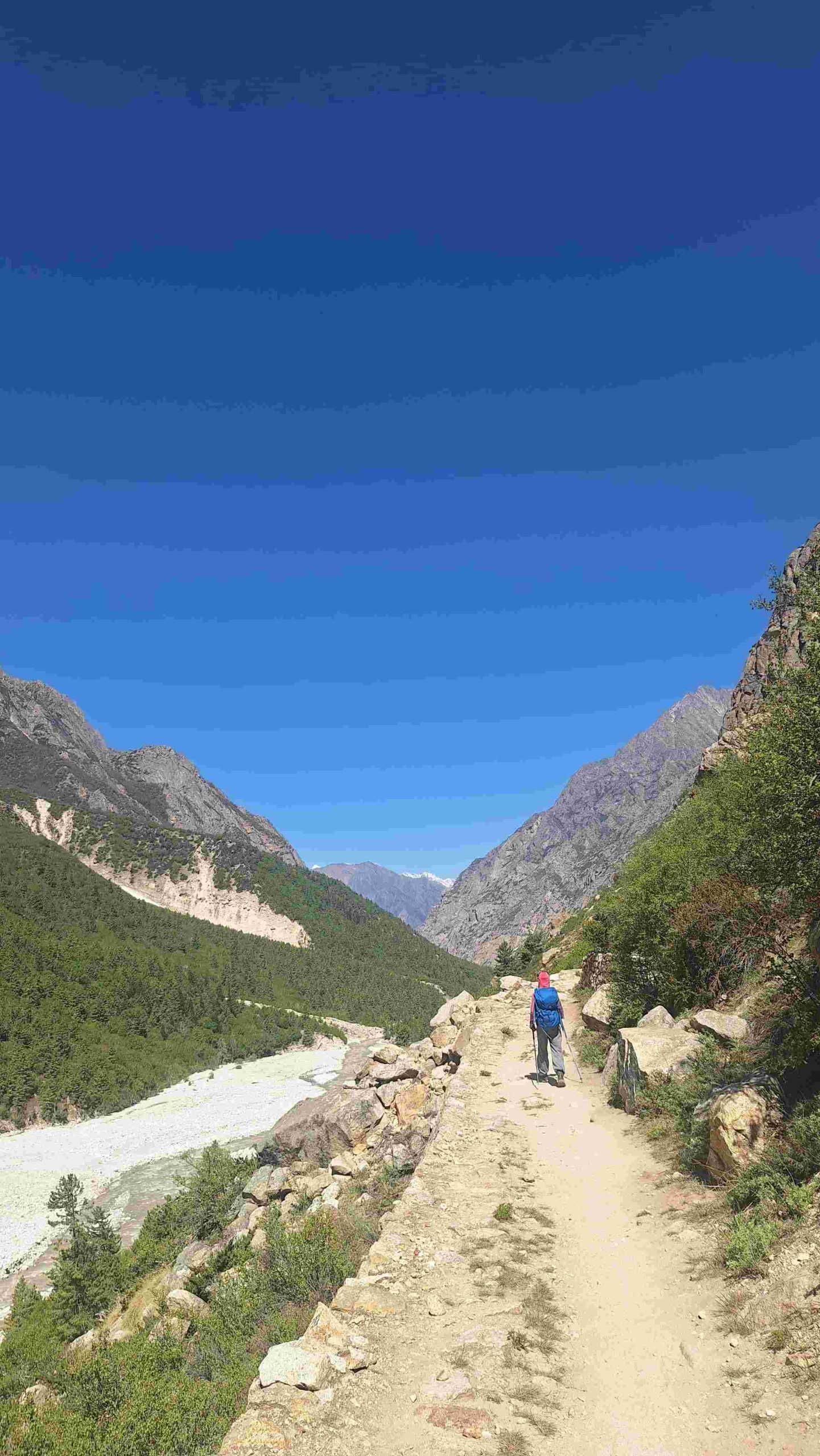
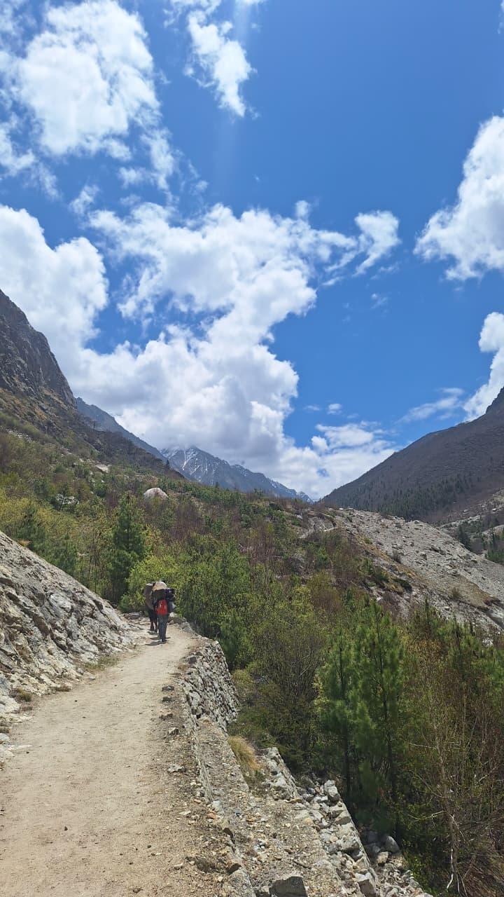
This is the first day of trekking. After breakfast, we start walking along the Bhagirathi River towards Gomukh, the snout of the Gangotri Glacier.
The trail passes through Chirbasa (3,600 m), meaning “land of pine trees.” The trek up to Chirbasa takes about 4 hours. After lunch, we continue to Bhojwasa, known for its birch trees. The scenery gradually changes from forested trails to barren, rocky terrain.
We reach Bhojwasa by evening and camp near the river, with stunning sunset views of the Bhagirathi peaks.
Day 4: Bhojwasa to Tapovan (4,460 m)
Distance: 13 km trek
After an early breakfast, we trek towards Gomukh, the source of the River Ganga. We spend some time at this sacred site before continuing to Tapovan.
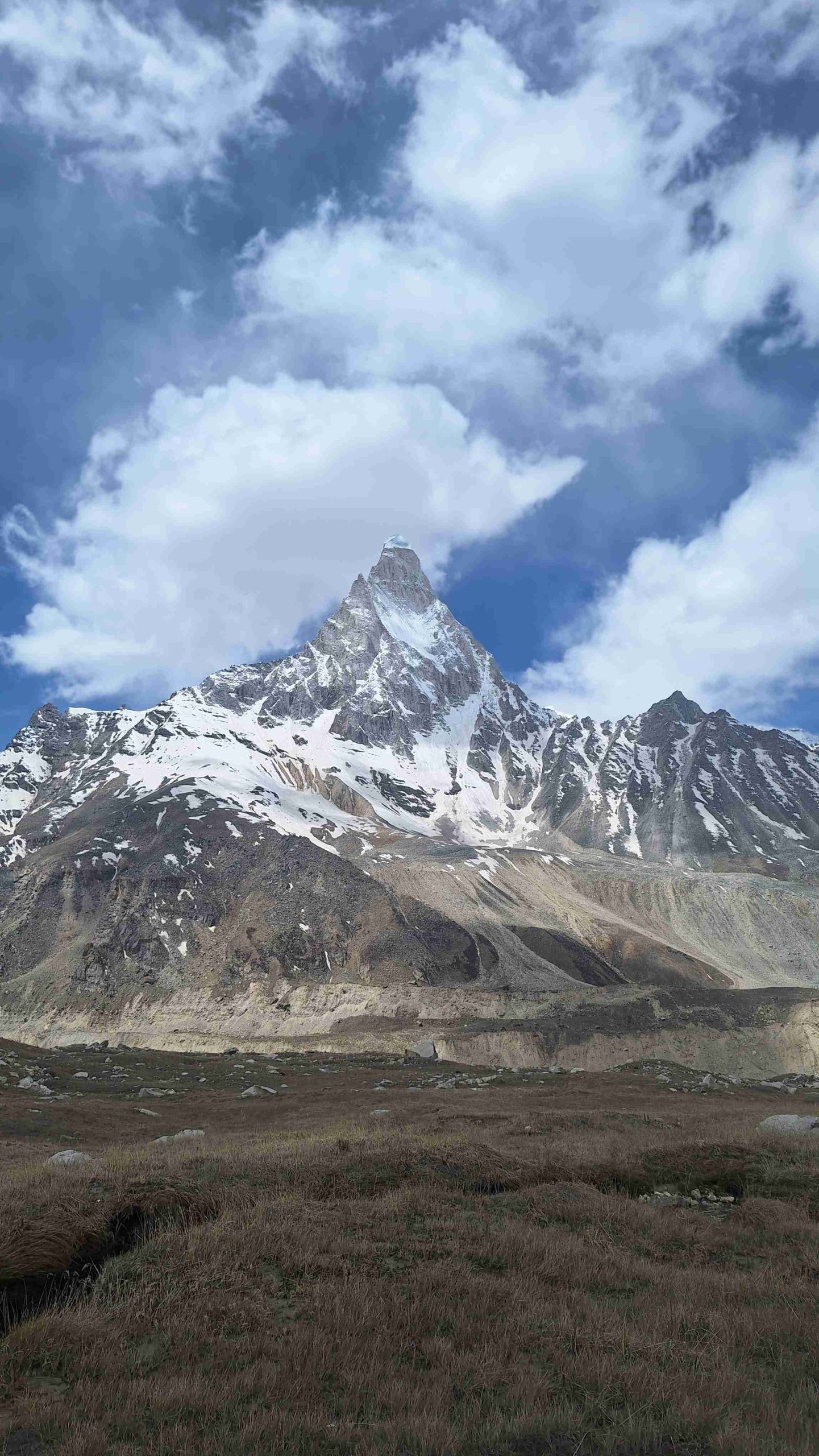
The trail beyond Gomukh becomes steeper and passes over moraine and glacier terrain. Tapovan is a beautiful alpine meadow located at the base of the iconic Shivling Peak. Surrounded by wildflowers, streams, and views of Bhagirathi I, II, and III, Tapovan is also known for frequent sightings of Bharal (blue sheep). Overnight stay in camps.
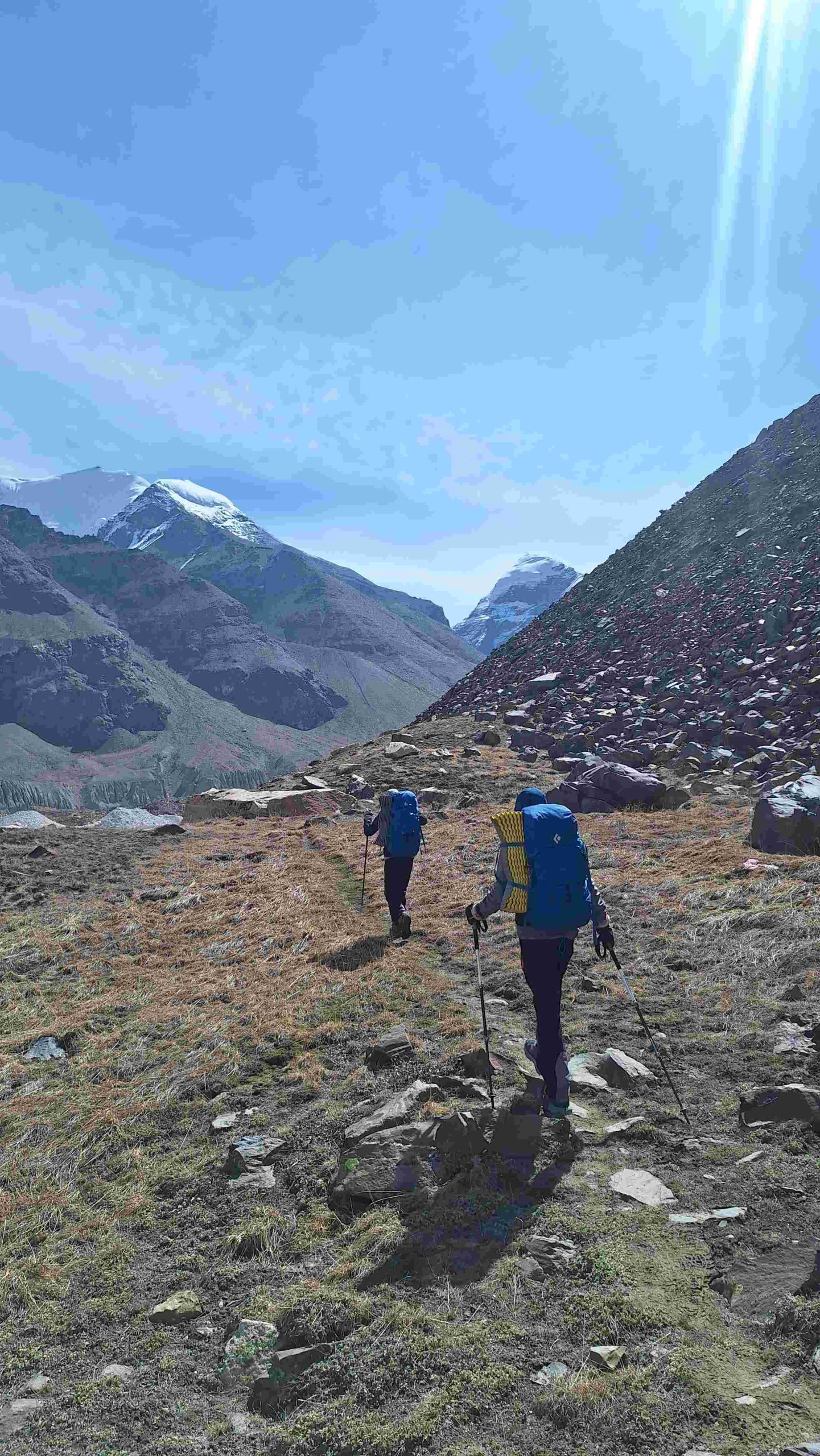
Day 5: Tapovan to Nandanvan (4,800 m)
Distance: 8 km trek
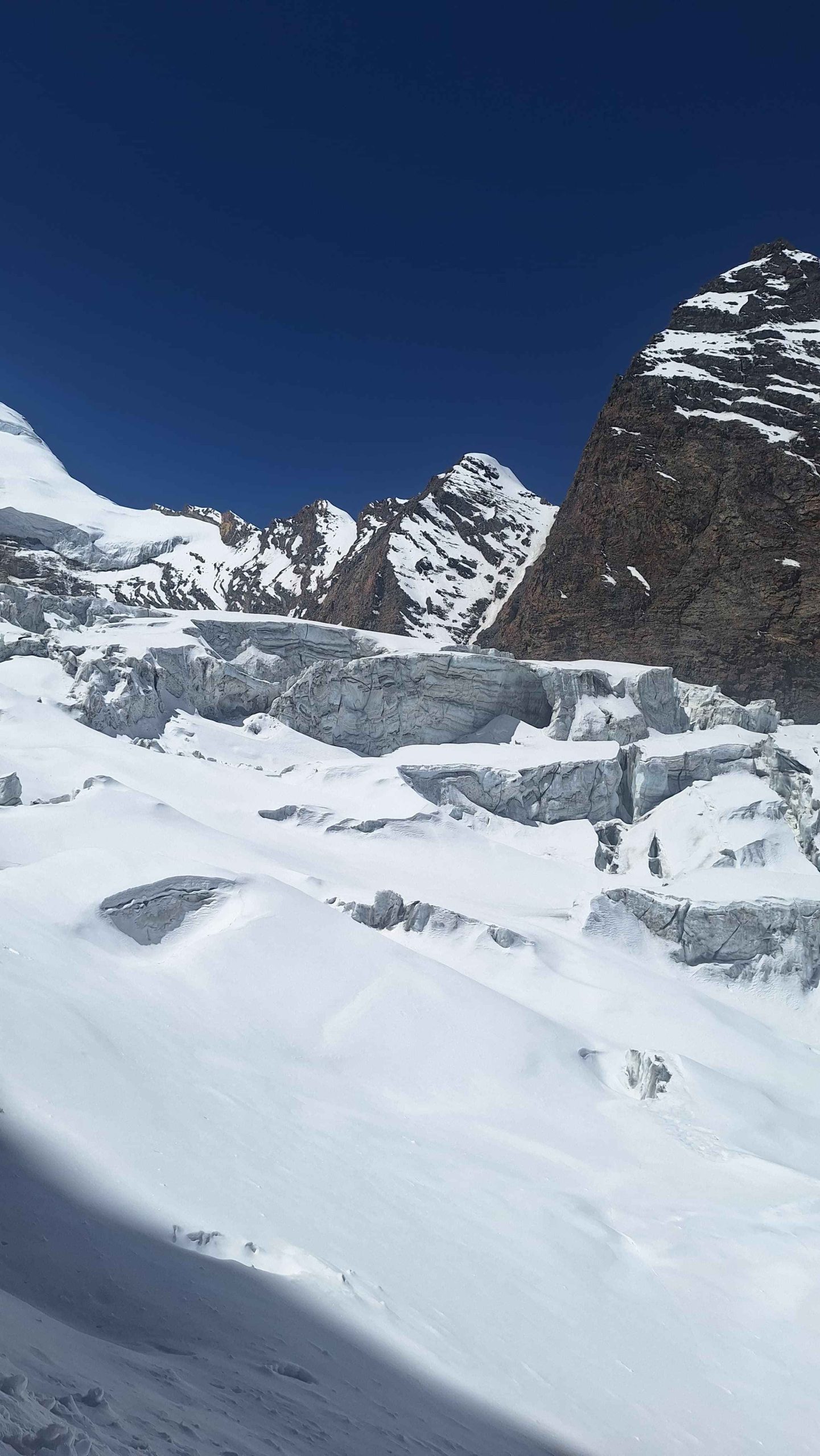
We start early and move towards the Meru Glacier before crossing glacial moraines towards Nandanvan. The trail is rocky and requires careful navigation due to loose rocks and hidden crevasses.
A steep ascent with boulders leads us to the Nandanvan campsite, which offers spectacular views of Shivling Peak. Overnight stay at Nandanvan.
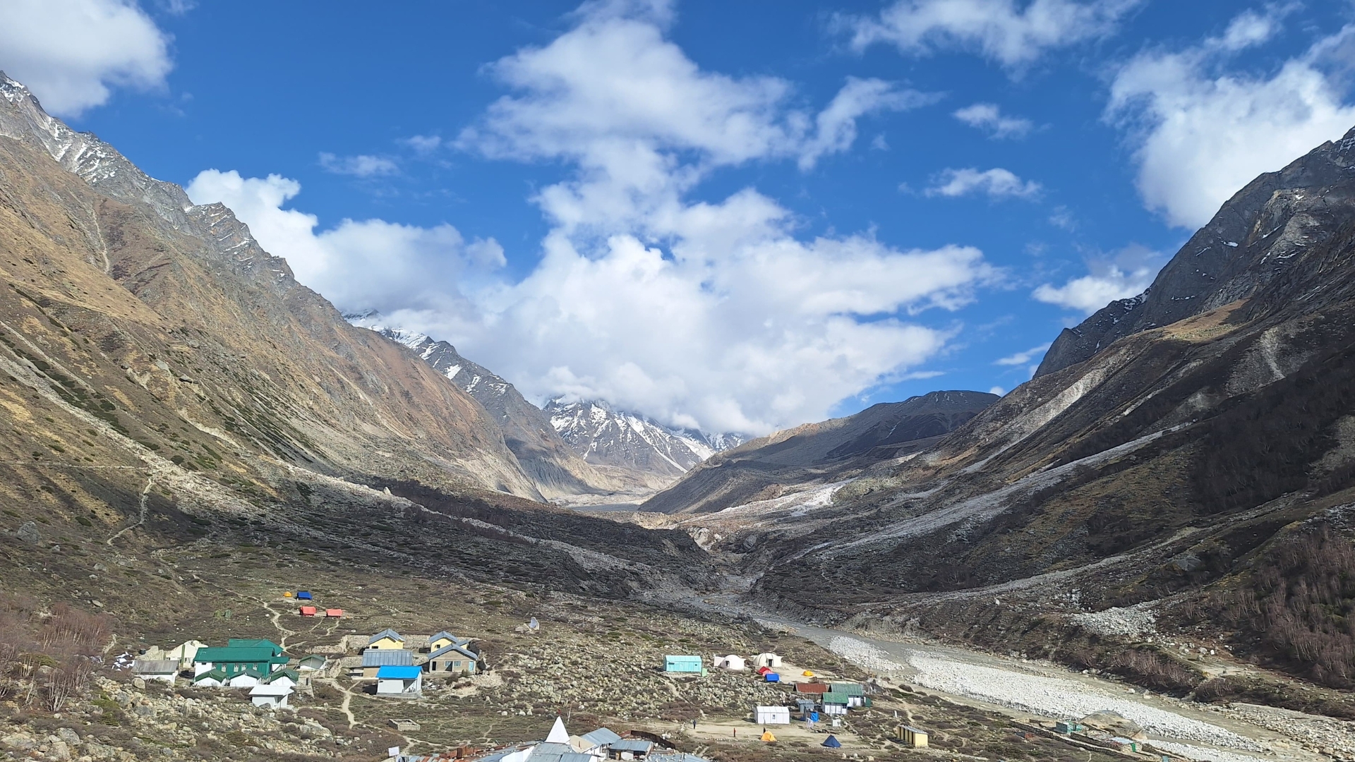
Day 6: Nandanvan to Vasuki Tal – Base Camp (4,876 m)
Distance: 6 km trek
Today involves a steady ascent along the Chaturangi Glacier. After a diagonal glacier traverse, short climb, and descent, we reach Vasuki Tal, a small high-altitude lake that serves as the base camp for the expedition.
The scale of the surrounding peaks gives a clear sense of the challenge ahead.
Day 7: Acclimatization at Base Camp
This day is dedicated to rest and acclimatization. Equipment is distributed, and technical training is conducted on nearby ice and snow slopes. The focus is on preparing both body and mind for higher camps.
Day 8 – Day 19: Expedition Phase
Weather and mountain conditions at high altitude are unpredictable, so daily plans remain flexible. This phase includes acclimatization rotations, rest days, and summit attempts.
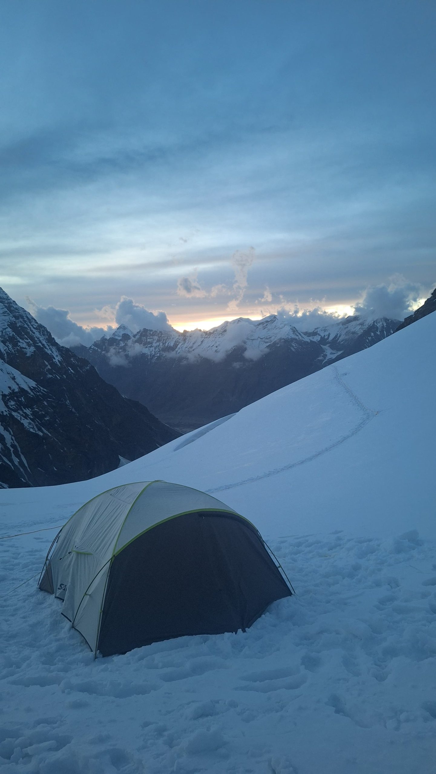
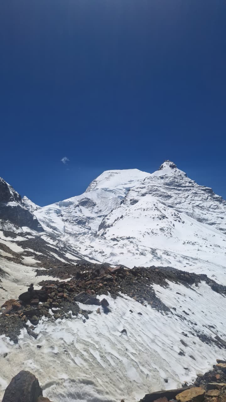
Mt. Satopanth has three high camps:
Camp 1: 5,130 m
Camp 2: 5,790 m
Camp 3 (Summit Camp): 6,200 m
The team follows the principle of “climb high, sleep low” to ensure safe acclimatization for more info Kailasa Treks.
Camp 1 (5,130 m)
Reached by walking along a narrow ridge with the Chaturangi Glacier on one side and Vasuki Parbat on the other. After descending towards the Sundar Glacier and crossing moraine terrain, Camp 1 is established.
Camp 2 (5,790 m)
This is a highly technical section involving ice walls, rock patches, and steep ascents. Fixed ropes and ascenders are used throughout the climb.
Camp 3 (6,200 m)
The summit camp lies on a hanging glacier and requires fixed ropes. The climb involves knife-edge ridges and steep ice faces.
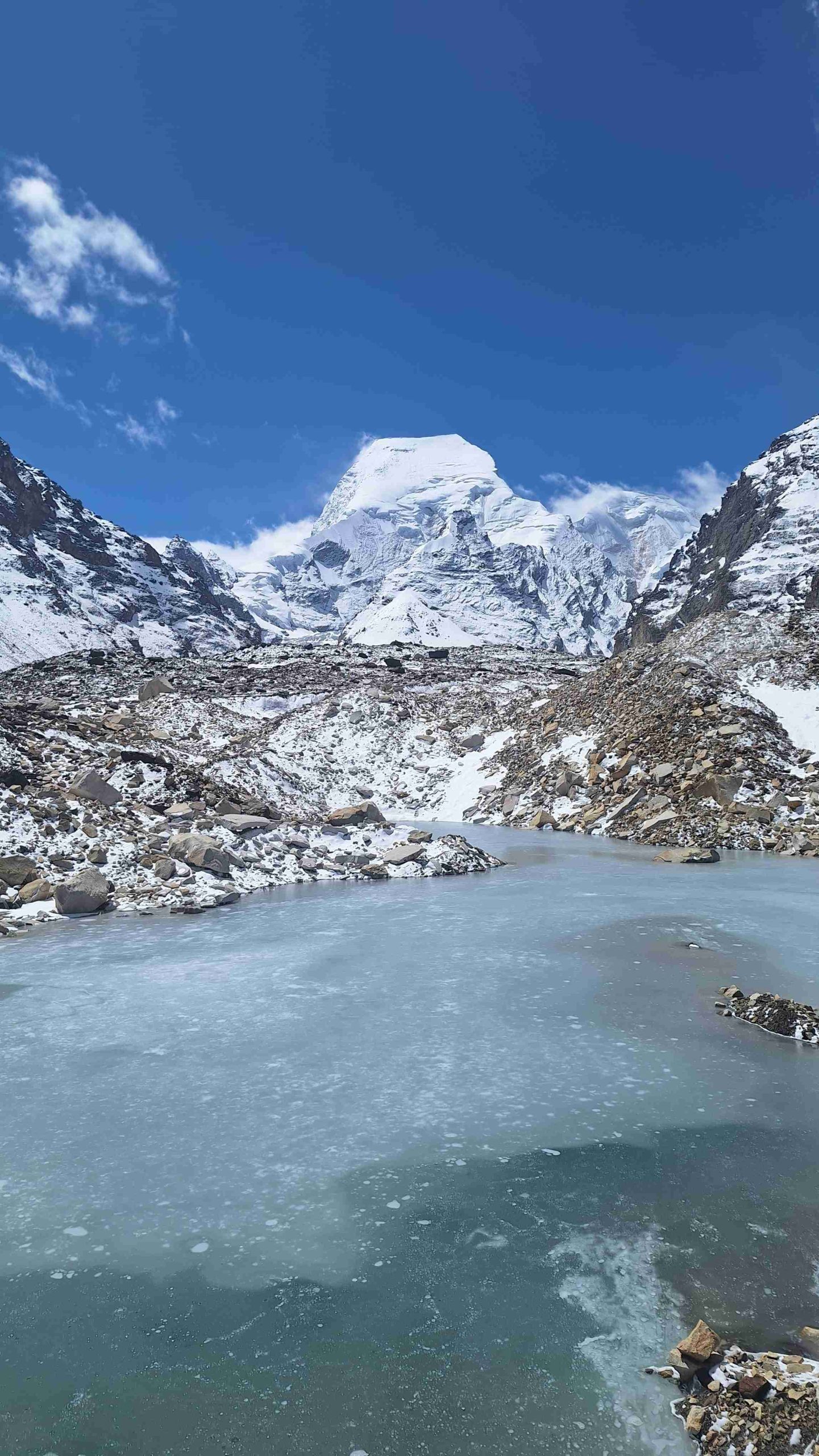
Summit Push (7,075 m)
The summit attempt begins between 11 PM and midnight to take advantage of stable ice conditions. The route follows the south face of the mountain and includes technical rock and boulder sections while wearing crampons.
From the summit, climbers are rewarded with breathtaking views of the Garhwal Himalayas to the south and the Tibetan Plateau to the north.
Descent: Summit Camp to Gangotri (5 days)
After the summit, the team descends carefully over multiple days, retracing the route back to Gangotri. Descents can be demanding, so focus and caution are essential. The trek concludes with a drive from Uttarkashi to Gangotri by Day 19.
Day 20: Reserve Day
Day 21: Reserve Day
Day 22: Reserve Day
Day 23: Departure from Gangotri
The expedition concludes with a celebration. Participants are advised to keep buffer days in their travel plans due to possible weather delays.
Other Treks
Gallery

What's Included
- Food as per menu on the expedition starting dinner on Day 1
- Forest Permits/Camping Charges (upto the amount charged for Indian nationals)
- 4 season Dome Tents, Thermal rated Sleeping bags, Sleeping mats
- Safety Equipment includes static rescue rope, seat harness, carabiners, pulleys
- Expedition guide, cook, helpers, HAP and LAP for carrying common supplies
- Course certified & experienced Expedition Leader with Wilderness Emergency Responder & Rescue. course from NIM Uttarkashi
- Technical Equipment – PP Ropes, Helmet, Ice Axe, Crampons, Mountaineering Boots, Snow Stake, Dead Man/Boy
- Peak Booking Fee Charges (upto the amount charged for Indian nationals)
- Hotel Stay in Gangotri on twin sharing basis.
What's Not Included
- Portage of personal bags during the expedition
- Meals during hotel stay in Uttarkashi & Gangotri
- Cost of any kind of Travel / Expedition Insurance.
- Only for foreign nationals US$ 1000 for a team of two members and US$ 450 for every additional participants
- Forest Permit / Camping Fee for foreign nationals (USD 880-1000 upto group of 10)
- Mandatory Liaison Officer Fee for foreign expeditions ( ~USD 500 for group of 10)
Frequently Asked Questions
Mt. Satopanth lies in the Garhwal Himalayas of Uttarakhand, near the Gangotri Glacier region. It is part of the famous trio of peaks along with Shivling and Bhagirathi.
Mt. Satopanth stands at an elevation of 7,075 meters (23,212 ft), making it one of India’s most prominent 7,000-meter mountains.
The climb is considered highly technical and physically demanding. The route involves:
Crevasse-filled glaciers
Steep ice slopes
Long mixed sections
Exposed ridgelines
Unpredictable weather
It is more challenging than most 6,000–6,500 m peaks and recommended only for trained mountaineers.
Yes. This expedition is for experienced climbers. You should have:
At least one high-altitude summit above 6,000 m
Knowledge of rope techniques
Experience with crampons, ice axes, and fixed lines
Strong endurance and fitness
A mountaineering certification is a strong advantage.
A full expedition typically takes 18–20 days, including acclimatization, rotations, and summit attempt windows.
Book a Tour
Error: Contact form not found.