Kalindi Khal Expedition
- Home
- Kalindi Khal Expedition

Kalindi Khal expedition (Max Altitude 5942 m)
Kalindi Khal – an extreme, technical high-altitude expedition
Kalindi Khal
Grade 6+Brief Description
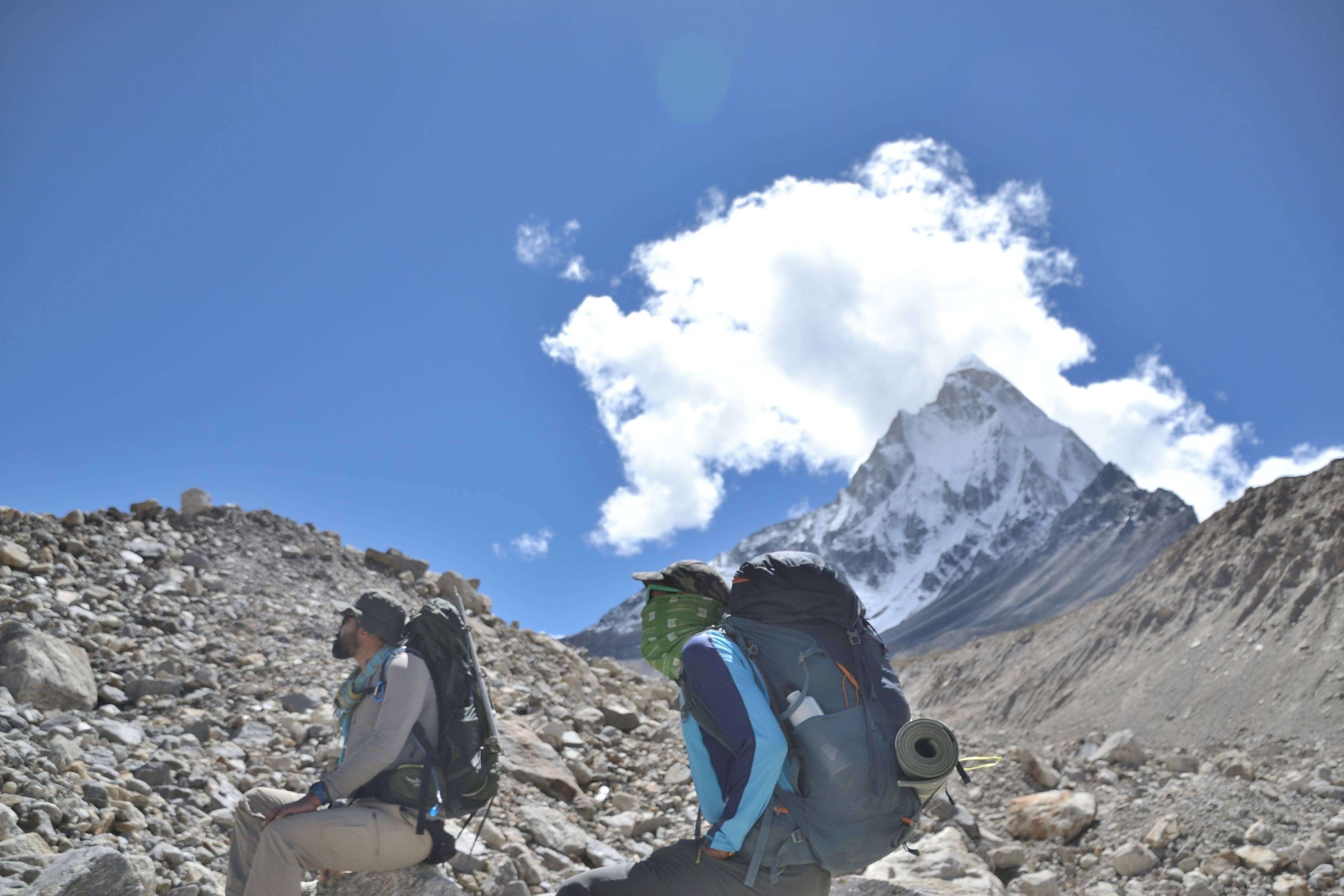
If you’re ready to move beyond high-altitude trekking and step into the world of serious Himalayan mountaineering, the Kalindi Khal Expedition is the ultimate challenge. Stretching across the Zanskar and Garhwal regions, this legendary high-altitude traverse takes climbers over glaciers, snowfields, and steep ice slopes, demanding both technical skill and mental resilience.
Kalindi Khal connects the Chandra Valley in Himachal Pradesh to the Bhagirathi Valley in Uttarakhand, crossing the iconic Kalindi Pass (5,942 meters)—one of the most technically challenging passes in the Indian Himalayas. Along the route, adventurers encounter crevasse-filled glaciers, unstable snow ridges, steep ice walls, and unpredictable high-altitude weather, all set against the backdrop of towering Himalayan peaks. This expedition is not just a physical journey, but a true test of endurance, teamwork, and mountaineering expertise.
The traverse is strictly for experienced climbers who are comfortable with advanced glacier travel, ice climbing, and high-altitude trekking. Prior mountaineering experience—ideally with peaks above 6,000 meters—is highly recommended. Kalindi Khal is a demanding expedition where preparation, skill, and determination define success.
Explore this page to learn everything you need to know about the Kalindi Khal Expedition—itinerary, routes, technical requirements, and essential guidelines for seasoned adventurers.
Brief Itinerary
Day 1: Arrive in Gangotri
Day 2: Rest & Acclimatisation in Gangotri
Day 3: Gangotri to Bhojwasa (12,467 ft) – 14 km
Day 4: Bhojwasa to Tapovan (14,632 ft) via – Gomukh (12,795 ft) – 13 km
Day 5: Tapovan to Nandanvan (14,271 ft) via Meru Glacier – 8 km
Day 6: Nandanvan to Vasuki Tal (16,010 ft) – 6 km
Day 7: Rest & Acclimatization at Vasuki Tal
Day 8: Vasuki Tal to Khara Patthar (17,060 ft) – 6 km
Day 9: Khara Patthar to Sweta Glacier (17,880 ft) – 8 km
Day 10: Sweta Glacier to Kalindi Base Camp (18,569 ft) – 6 km
Day 11: Kalindi Base Camp to Rajaparav (16,076 ft) via Kalindi Khal (19,488 ft) – 13 km
Day 12: Rajaparav to Arwa Tal (14,763 ft) – 13 km
Day 13: Arwa Tal to Badrinath (9,842 ft) via roadhead at Ghastoli (12,467 ft) – 12 km
Day 14: Badrinath to Dehradun – 295 km drive
Day 15: Reserve Day
Detailed Itinerary
Day 1: Arrive in Gangotri (3,415 m)
Reach Gangotri by road (via Dehradun, ~242 km) by 3 PM
Check into the Guest House/Hotel (details provided via email)
Evening free to explore local market, temples, and surroundings
Overnight at Gangotri
Day 2: Rest & Acclimatization at Gangotri (3,415 m)
Full day for rest and acclimatization
Light movement in the area to help the body adapt to altitude
Day 3: Gangotri → Bhojwasa (3,800 m / 12,467 ft)
Distance: 14 km | Moderate trek
Trek to Chirbasa (3,600 m), along Bhagirathi River
Pack lunch at Chirbasa
Continue to Bhojwasa; campsite near the river
Enjoy sunset views of the Bhagirathi peaks
Overnight in tents
Day 4: Bhojwasa → Tapovan (4,460 m / 14,632 ft) via Gomukh (3,890 m / 12,795 ft)
Early morning trek to Gomukh, source of River Ganga
Continue ascent to Tapovan alpine meadows, base of Shivling Peak
Scenic meadows, streams, wildflowers, and Bharal sightings
Overnight camping at Tapovan
Day 5: Tapovan → Nandanvan (4,340 m / 14,271 ft) via Meru Glacier
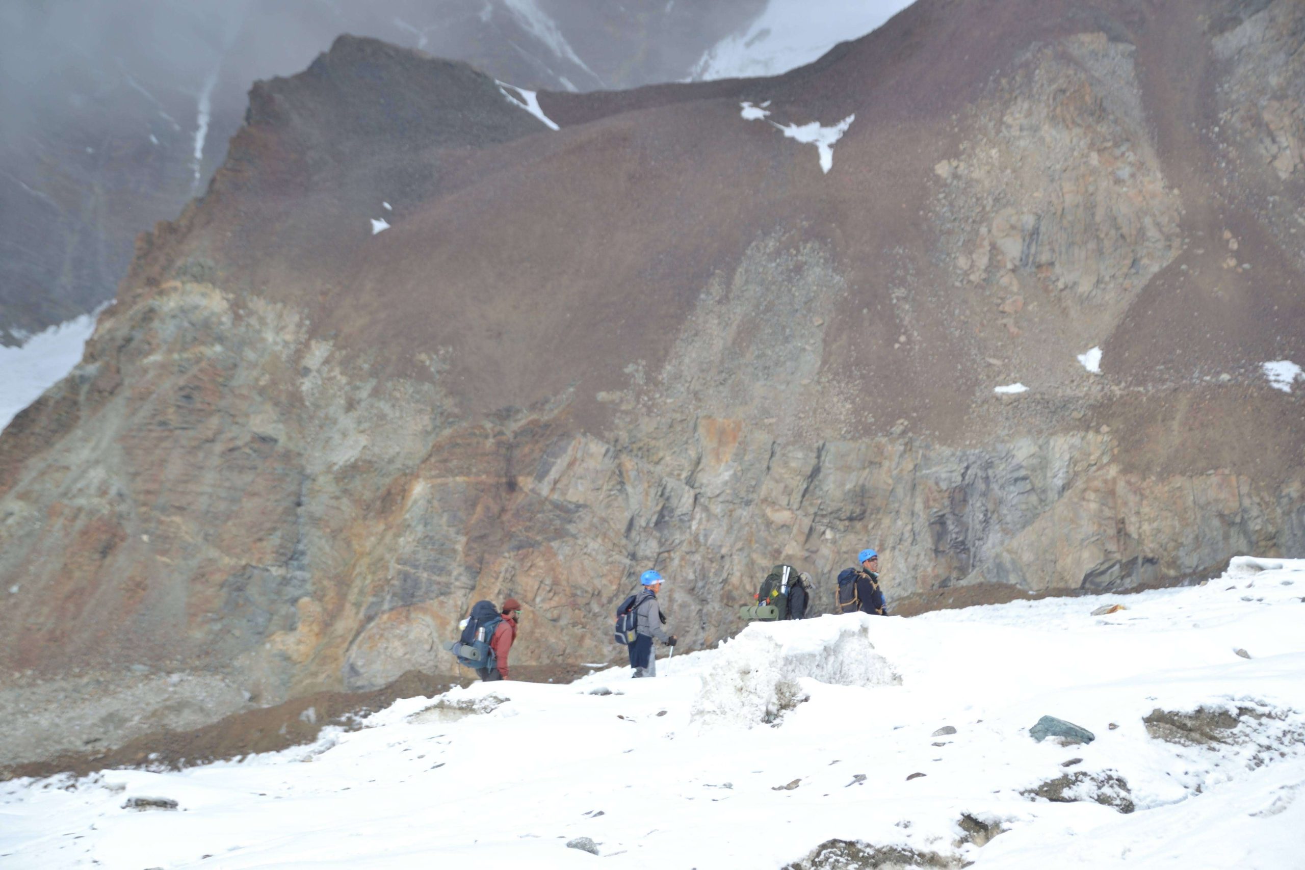
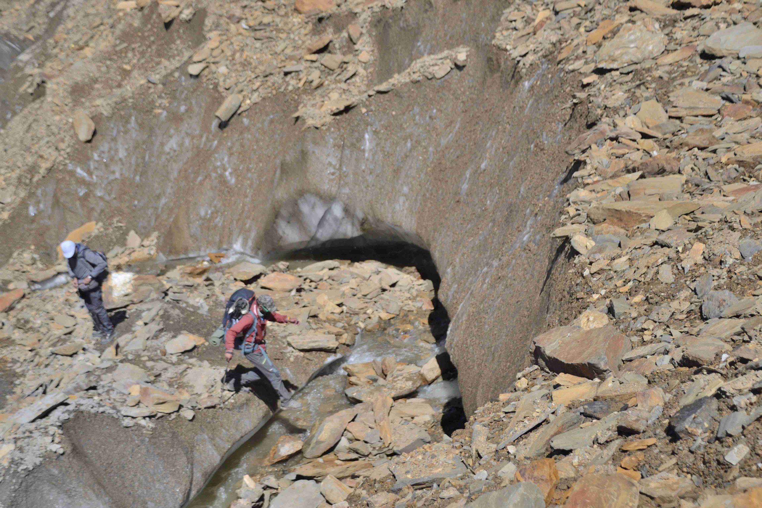
Trek across Meru Glacier to Nandanvan
Terrain: glacier walking with rocky moraine and crevasses
Steep vertical ascents with careful footing
Overnight in tents
Day 6: Nandanvan → Vasuki Tal (4,880 m / 16,010 ft)
Trek along Chaturangi Glacier to Vasuki Tal
Stunning base for Mt. Satopanth and Mt. Vasuki Parbat
Steady ascent, moderate trek
Overnight camping
Day 7: Rest & Acclimatization at Vasuki Tal
Full day for acclimatization
Optional short walks around the lake
Day 8: Vasuki Tal → Khara Patthar (5,200 m / 17,060 ft)
Trek duration: ~6 hours
Spectacular views of Mt. Satopanth
Overnight camping at Khara Patthar
Day 9: Khara Patthar → Sweta Glacier (5,450 m / 17,880 ft)
Short trek for acclimatization
Campsite on moraine with rocky terrain
Day 10: Sweta Glacier → Kalindi Base Camp (5,660 m / 18,569 ft)
Early start for short trek in moraine area
Pass Chaturangi Glacier with its unique four-colored rocks
Camp at Kalindi Bamak, near Kalindi Glacier snout
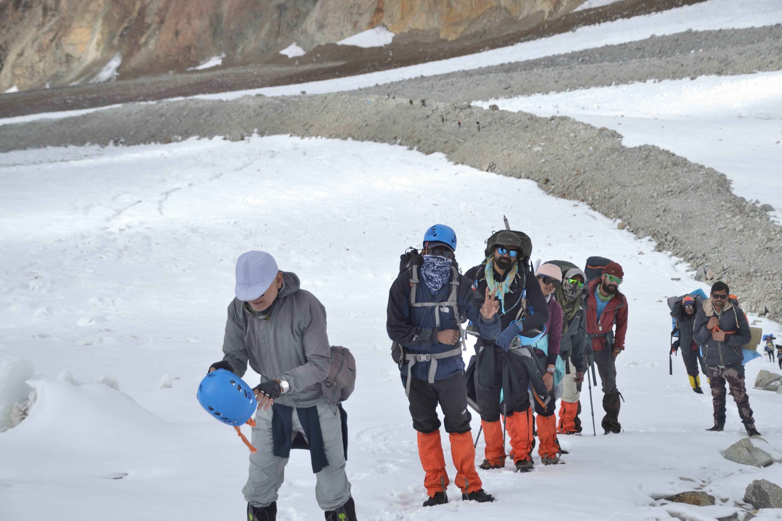
Day 11: Kalindi Base Camp → Rajaparav (4,900 m / 16,076 ft) via Kalindi Khal (5,940 m / 19,488 ft)
Summit Day: early morning start
Continuous ascent to Kalindi Khal Pass
Views of Mt. Kamet, Mt. Mana, Chandra Parbat, Vasuki Parbat, and Tibetan Plateau
Camp at Rajaparav after crossing the glacial terrain
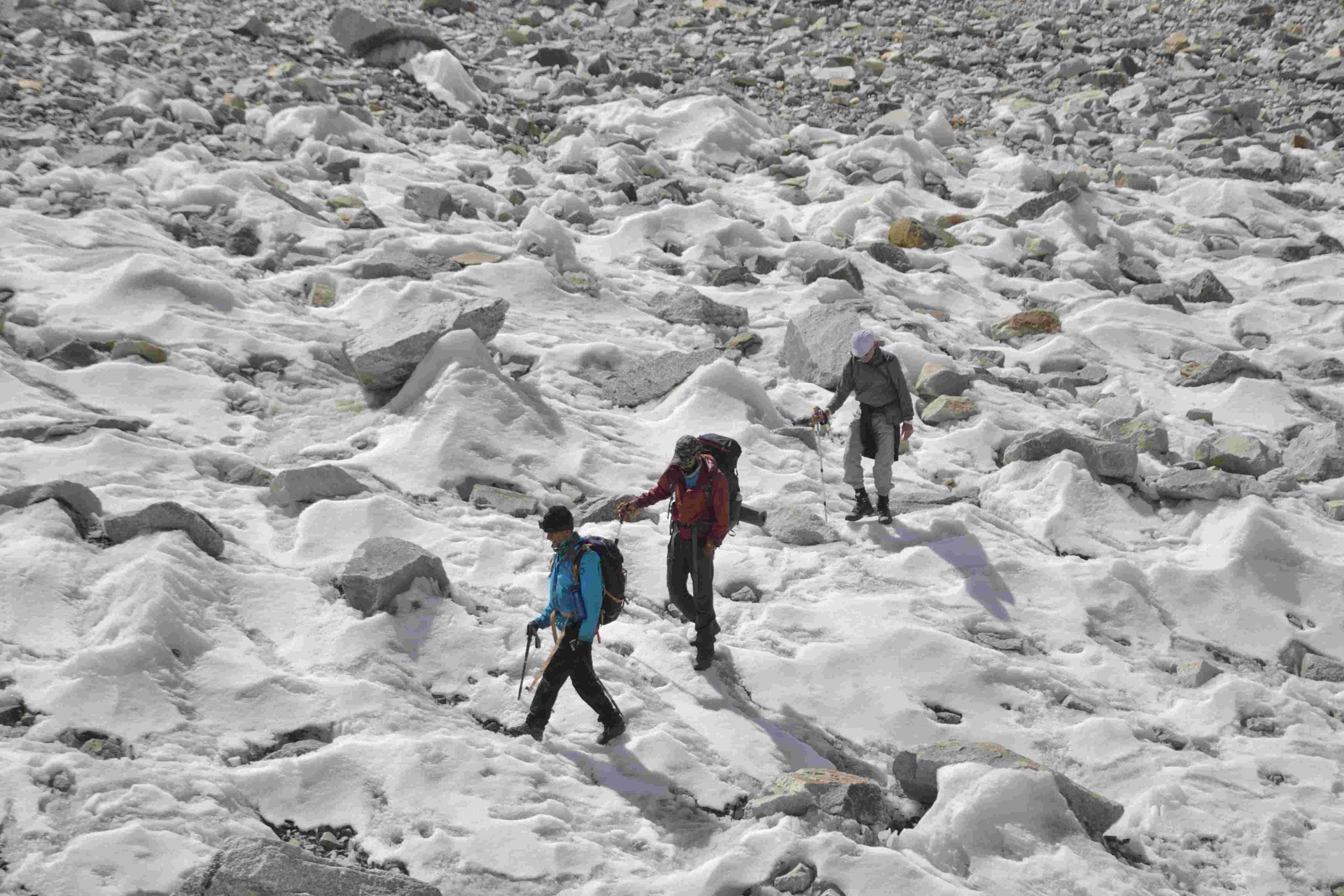
Day 12: Rajaparav → Arwa Tal (4,500 m / 14,763 ft)
Long walk on glacier terrain
Overnight camping at Arwa Tal
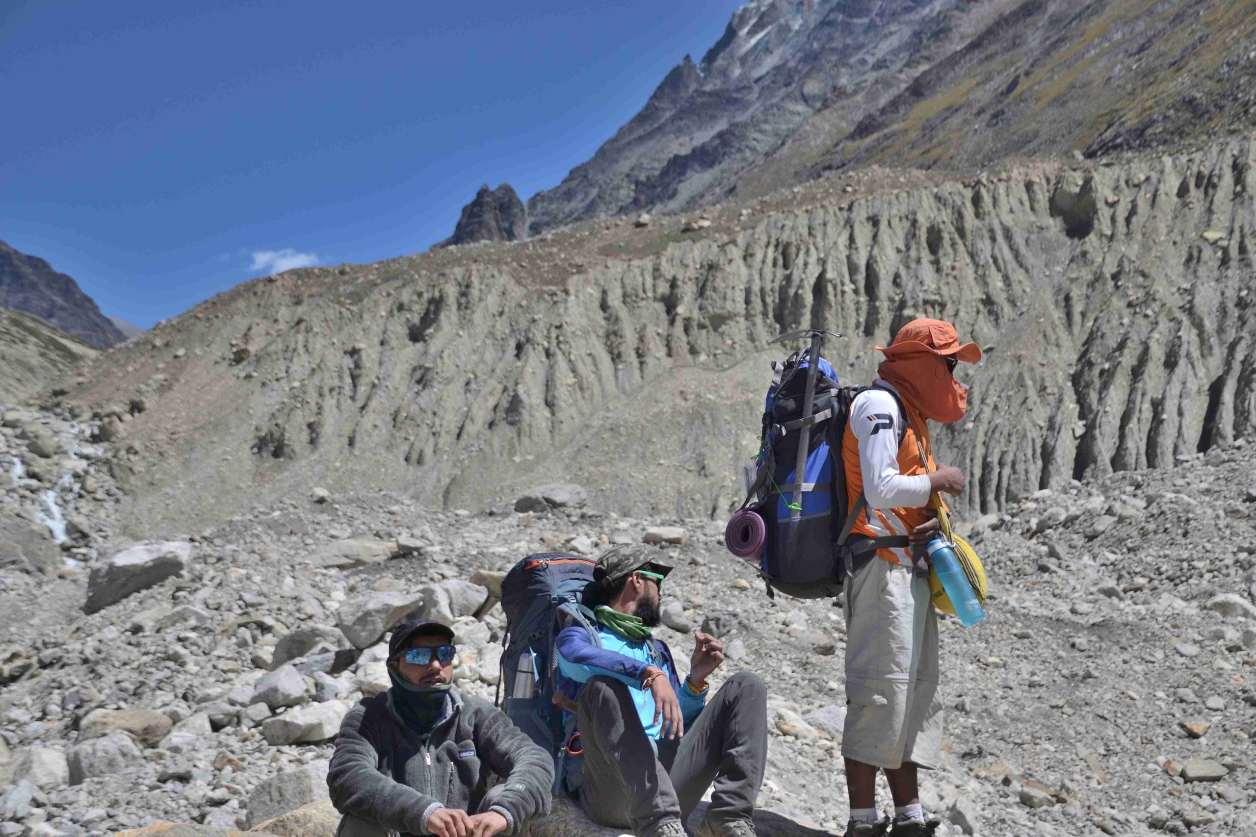
Day 13: Arwa Tal → Badrinath (3,000 m / 9,842 ft) via Ghastoli (3,800 m / 12,467 ft)
Trek through moraines to Ghastoli meadow
Drive down Mana Pass road to Badrinath
Overnight stay at Badrinath
Day 14: Badrinath → Dehradun (295 km)
Drive along Alaknanda River via Devprayag to Dehradun
Board overnight bus/train for onward journey
Day 15: Reserve Day
To be used only if required due to bad weather or unforeseen circumstances
Optional buffer day: Rs. 4,500/day + 5% GST per person (collected by Trek Leader)
Other Treks
Gallery


What's Included
- Food as per menu on the trek starting breakfast on Day 3 till lunch on Day 13
- Forest Permits/Camping Charges, if any (upto the amount charged for Indian nationals)
- Tents, Sleeping bags, Sleeping mats
- Safety Equipment includes static rescue rope, seat harness, carabiners, pulleys
- Trek guide, cook, helpers, and porters for carrying common supplies
- Mountaineering course certified Trek Leader with Wilderness Emergency Responder & Rescue. course from NIM Uttarkashi
What's Not Included
- Portage of personal bags during the trek
- Cost of any kind of Travel Insurance.
- Any Expense of personal nature.
- Any Expense not specified in the inclusions list.
- Meals during hotel stay & road journeys
Frequently Asked Questions
Kalindi Khal is a highly technical and challenging high-altitude expedition. It requires experience in glacier travel, ice climbing, and high-altitude trekking. It is suitable only for experienced mountaineers.
The ideal window is June to September, when the weather is relatively stable, snow conditions are manageable, and the risk of avalanches is lower.
The expedition typically lasts 18–20 days, including acclimatization, approach, crossing the Kalindi Pass, and the return journey.
The Kalindi Pass (5,942 meters) is the highest point, and it involves steep snow slopes and glacier crossings.
Yes. Climbers should have experience in:
Glacier trekking and crevasse navigation
Ice and snow climbing techniques
High-altitude expeditions (preferably above 6,000 meters)
Rope team travel and use of technical gear
Yes. Required equipment includes:
Crampons, ice axe, harness, helmet, ropes, and mountaineering boots
High-altitude clothing and personal gear (gloves, down jacket, sleeping bag, etc.)
Group climbing equipment is usually provided by the expedition operator. for more info Kailasa Treks.